
Jackson County Neighbors Around a Block
The best evidence around one address is parcel-based. JIM can show nearby taxlots and site-address context. PDO gives an account-by-account property view. The Clerk can connect a selected parcel to a recorded document. Historic sources can explain an older building or road. Each source has a boundary, and none is a countywide household directory.
| Source | What it shows about a block | Access |
|---|---|---|
| JIM Property / Taxlots2 | Nearby parcel boundaries, site-address context, and published parcel, account, owner-mailing fields | Map browse, click, and attribute table; not a list of every household member |
| PDO property accounts | Owner or agent context, tax-notice fields, sale/deed-card and permit leads for one parcel | Run separately for each account |
| Clerk / DRR | Recorded parties, legal descriptions, and instrument history for a chosen parcel | Specific parcel or deed chain, not a whole-block search |
| Formal voter file | Statutory public fields and precinct geography, subject to exclusions | Statutory request path, not My Vote browsing |
| SOHS Address Index and historic maps | Historic property sources, old roads, surveys, and date-specific building context | Historical research route, not current neighbors |
| Community programs | Public participation or planning pathways | No verified countywide member directory |
Owners and occupants are different categories. A fee-owner, contract, or mailing field may identify a property relationship, while people who live at the site may not appear in any public parcel field. Keep the record attached to the parcel and date it describes.
Jackson County GIS Block Evidence
The Taxlots2 service is the published field source behind the parcel layer. It includes Assessor map, map taxlot, legacy map/taxlot, account, township/range/section fields, fee owner, contract, in-care-of, mailing address, acreage, assessed values, and land-use-zone data. Separate site-address points and polygon taxlots help place the record geographically.
The service says it is updated weekly, and County instructions say property taxlots refresh Friday mornings. Freshness does not change its purpose. The layer has a 2,000-result maximum and is not the legal title record. A question about title, a transfer, or a precise legal description belongs with the Clerk’s recorded instrument rather than the GIS display.
The County GIS Taxlots2 service is the source shown in this Jackson County neighbors capture.
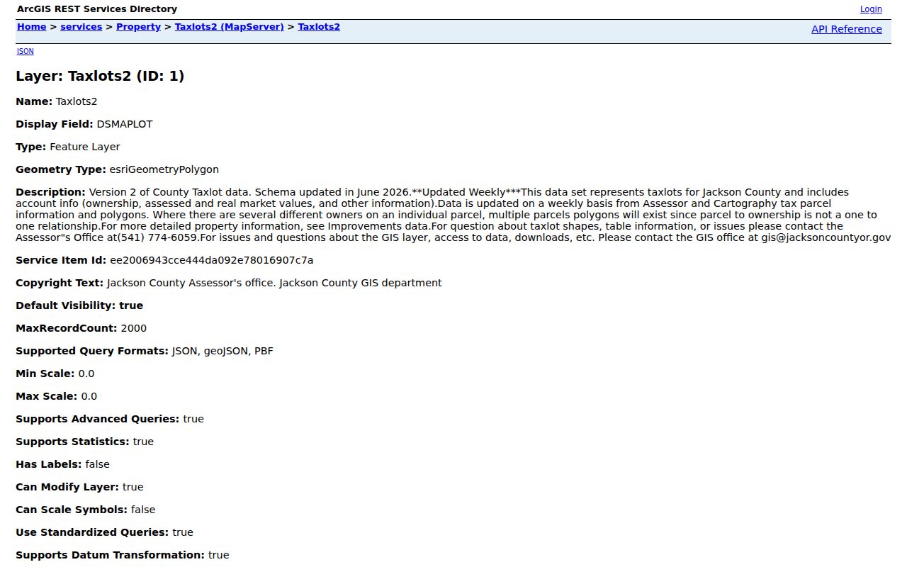
Read the displayed fields as land and assessment context. They make it possible to compare adjacent parcels carefully, but they do not identify every person associated with a block.
Jackson County Neighbor Mailing Myth
Myth: a tax mailing address identifies who lives at the parcel. A physical site is called the situs address in the local property context. The Taxlots2 schema separately provides mailing fields for a fee owner, contract party, or care-of contact. Those fields can differ for ordinary reasons, including an agent, trust, post-office box, business, or another residence. They should never be treated as proof that a particular person lives at the parcel.
PDO gives the same distinction practical importance. It can return property-account context, but the County does not document a public flag that resolves current occupancy. A site can be used by a person who does not appear in the tax record. Conversely, an owner may receive tax notices elsewhere. Jackson County neighbors research is therefore about documented property relationships, not an inference about a household.
The County’s Taxation address-change procedure reinforces the point. It is an owner or agent notice path for a listed property. A change to the mailing field changes where official tax correspondence is sent. It does not change the situs, establish that someone occupies the site, or create a lawful source for publishing private contact details.
Jackson County Neighborhood Resources Verified
No verified countywide HOA, neighborhood-association, or civic-member directory was found. Local material identifies planning and preparedness routes, but not a general roster of members or residents. This is a useful result: a neighborhood name or program does not authorize collection or republication of private contacts.
| Community resource | What was verified | What was not verified |
|---|---|---|
| Countywide association inventory | No official countywide umbrella inventory was located. | No member or contact directory. |
| Medford neighborhood associations | The 2040 Action Plan says the City will explore and consider formation during 2025 through 2028. | A present umbrella association or resident roster. |
| Ashland Firewise USA neighborhoods | Ashland reports 36 historically active recognized neighborhoods, with the first seven established in 2011, and states participation criteria. | A named current member or household directory. |
| Ashland Better Prepared Neighborhoods | Presentations and neighborhood walk-throughs are offered. | An association roster. |
| Ashland planning documents | North Mountain, Railroad Property, and Croman Mill planning documents identify geographic planning areas. | Civic membership lists. |
Ashland’s Firewise USA page documents the participation criteria and program history behind the following Jackson County neighbors image.
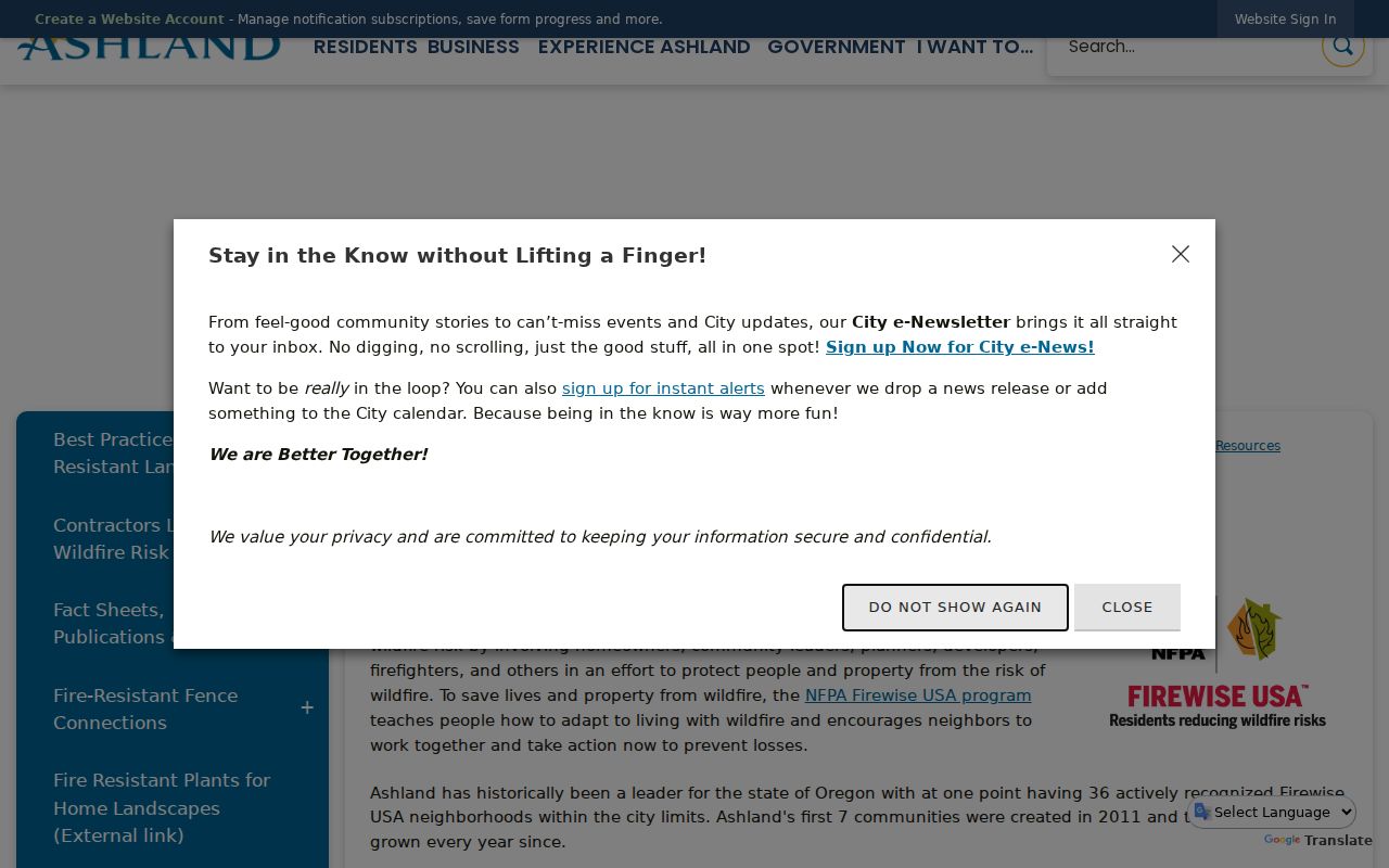
Assessment and action planning, a task-force committee, annual cleanup, volunteer time, and annual reporting are program conditions. They do not turn the program into a directory of neighbors.
Jackson County Neighbor Voter Boundaries
Oregon My Vote is self-service. A voter enters a name and date of birth to view or update that voter’s registration, ballot status, and related information. It is not a way to browse a street, identify nearby voters, or obtain a block roster. Direct a person who needs to check their own registration to Oregon My Vote.
The formal voter-file path is separate. Oregon law identifies limited public fields that can include party affiliation, residence and mailing address subject to exclusions, birth year, precinct, participation history, and certain election-period status information. Ballot choices remain secret. Protected participants, full birth dates, identification numbers, and signatures are withheld. Jackson County Elections can address a narrowly framed statutory request, but it must follow the applicable restrictions.
Note: A formal elector file has defined statutory fields; it is not evidence of every person living around an address.
Map Jackson County Neighbor Parcels
The documented adjacent-parcel method begins in the County’s JIM viewer. It is designed for a tight, visible area around an address, not for a broad person search. Zoom far enough to distinguish parcel polygons and the target site, then inspect each nearby taxlot separately. Multiple polygons can relate to multiple ownership interests, so one shape or one owner field is not a complete account of the people nearby.
- Search JIM by street, site address, account, or map/taxlot and open the target taxlot.
- Pan to each immediately adjacent taxlot, or use the attribute table in the current extent. Note its account, map/taxlot, and published site-address context.
- Toggle property layers and use the draw, measure, or attribute tools only to understand the immediate parcel pattern. Keep each parcel boundary distinct.
- Open PDO for a selected parcel if an account or sale/deed-card lead is needed. Use DRR only after a document reference or legal description points to a specific record.
The flow is address → target taxlot → adjacent taxlots → individual property accounts → selected recorded instruments. For a full named-street deed chain, use the Jackson County street directory route instead of expanding a block search into an unbounded list.
Historic Jackson County Neighbors
Historic sources answer a different question: who or what was connected with a place at a particular time. Start with the target parcel and the parcels on either side. Compare legal descriptions and recorded dates, then add a Sanborn sheet only for the year it covers. A directory or census entry should likewise be limited to the year and community it documents.
SOHS’s Address Index can lead to a title, survey, address, city, or source record. JCLS holds local-history materials and Sanborn microfilm, while RVGS and the State Archives preserve other historical land, court, probate, and local sources. A historic map may establish a building footprint or road label. It is not a claim about current Jackson County neighbors.
Jackson County Neighbors Source Comparison
Official records and generic commercial neighbor tools are not interchangeable. The official route identifies the custodian, field limits, and record date. Generic commercial tools commonly combine data from many sources and can be stale or wrong. Neither category should be used to guess an unverified household connection.
When a result conflicts with a parcel, instrument, or dated archive source, return to the official custodian and compare the record’s identifier and date. A current-looking name or address without a source trail is not confirmation.
| Official local record | Generic commercial neighbor tool | Practical difference |
|---|---|---|
| PDO, JIM, Clerk, and documented archives identify their source and record type. | Often compiles information from disparate sources with unclear update timing. | Official records support a specific parcel, instrument, or dated historical source. |
| Privacy limits and protected-address rules apply to the government record path. | May repeat inaccurate or stale information without establishing a current property relationship. | Do not use either to make a claim about a private household. |
| Access channels include online portals, the Clerk, Development Services, libraries, and archives. | Does not replace a custodian’s record or a certified copy where one is needed. | Return to the responsible office for correction or confirmation. |
Jackson County Neighbors Privacy Limits
Private household membership is not a public block dataset. Utilities, delivery or customer data, DMV residential information, private association membership, renter names, and household composition are outside the nearby-parcel workflow. Safe at Home and protected voter information receive separate protections. Do not attempt to use one public field to work around an address safeguard.
Oregon law distinguishes ordinary access from misuse. Oregon’s anti-doxxing, stalking, and harassment laws address conduct and intent. Public records may support lawful personal, family-history, estate, civic, and property research. They do not justify contacting, following, threatening, shaming, or repeatedly disturbing a person.
Lawful use. Use block-level records carefully and only for lawful purposes. Respect protected-address boundaries and stop where the available record no longer supports the question.